Badlands & Bikers – Keystone, SD, UDSA, July 30, 2022

Badlands & BikersKeystone, SD, UDSA, July 30, 2022

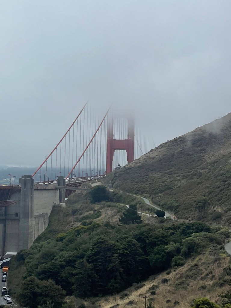
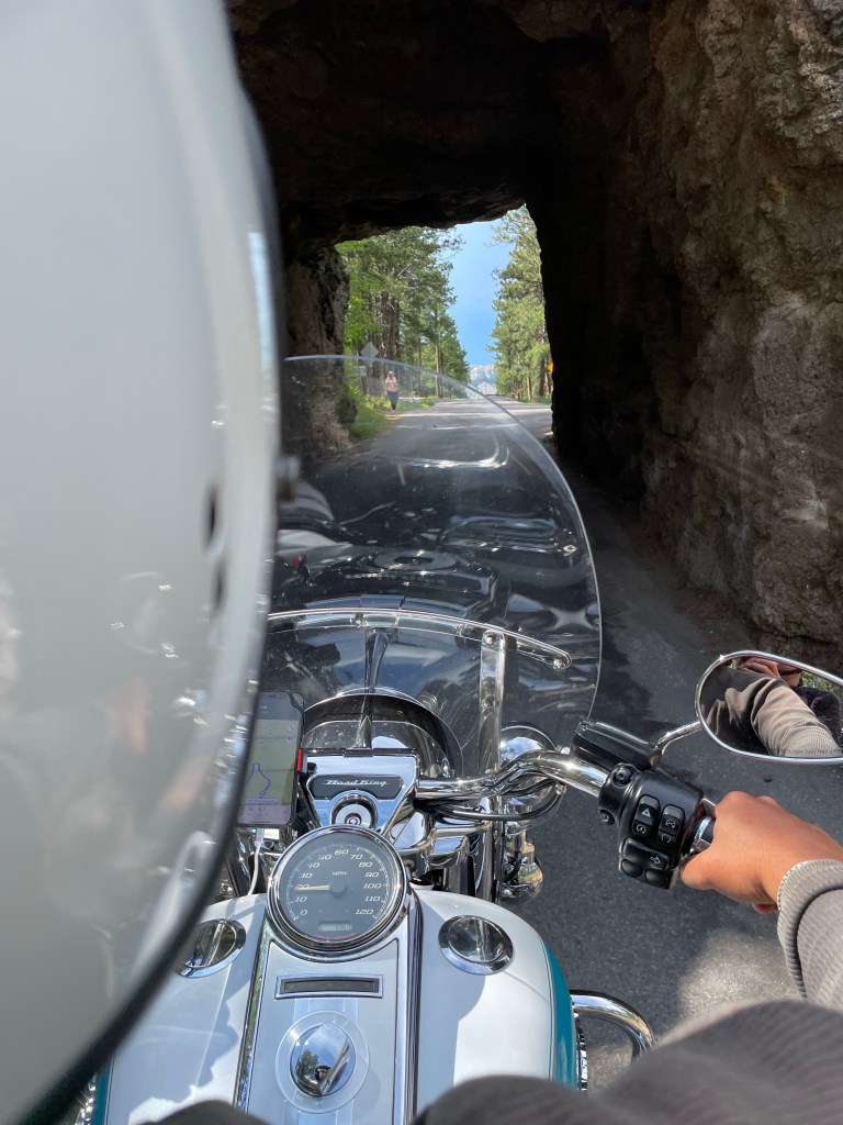
Ron and I had a blast in South Dakota.  We started in Sturgis and spent one night there, one in Keystone, and our last in Kadoka (OK  – not as fun here).  Not only was Ron able to get every needed bike part including changed brakes in Sturgis but we also got our rally t-shirts.  Both of us had been to bike week in Daytona when we were young (Ron many times since his parents would go every year) and I had happened to be there during spring break one year.  This impression was still fresh enough (some 30+ years later) that I really didn’t feel the need to experience Sturgis during the actual week of the rally but was fine being there early.  We then moved onto Keystone to drive Needles Highway and to see Mount Rushmore.

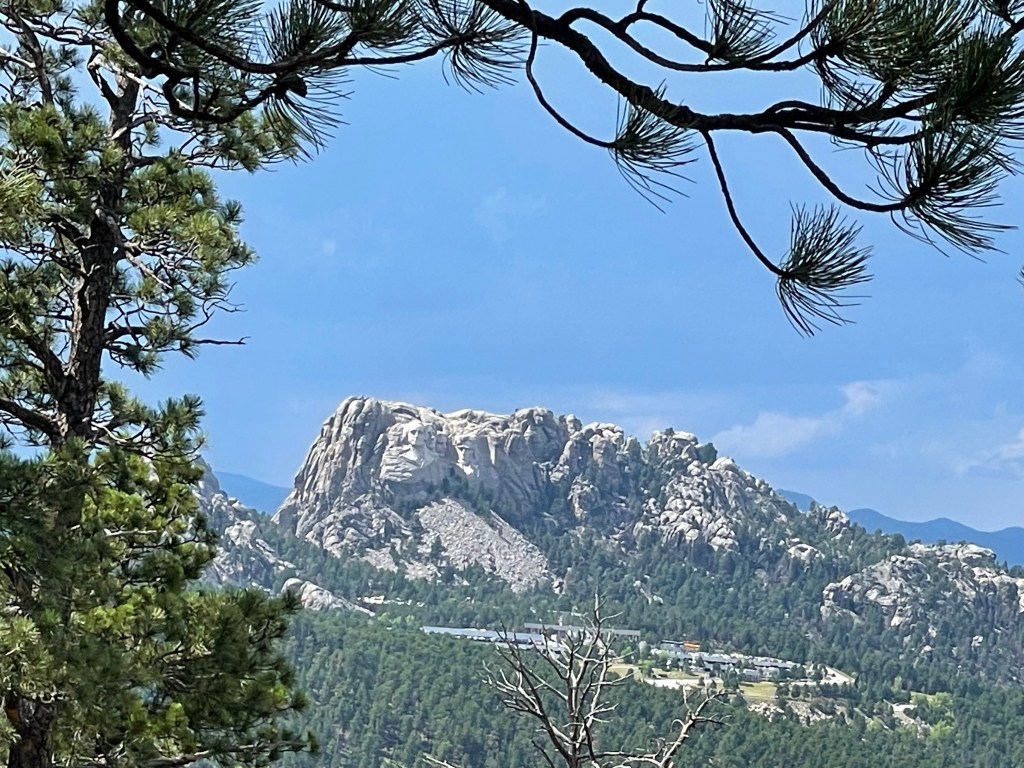
We had a chance to see Mount Rushmore from Needles Highway even though it rained on us.  I do have to say Mount Rushmore was cooler than I thought but also smaller.  Did you know there is a national vault hidden behind Lincoln’s head holding the Declaration of Independence?  There is quite a bit on controversy around Mount Rushmore and the Indians are “retaliating” by carving Crazy Horse which is the largest carving in process in the world.  There is currently no completion date planned.

The four presidents were chosen for specific purposes.  George Washington since he was responsible for the “birth” of our nation.  Thomas Jefferson since he wrote the Declaration of Independence and made the Louisiana Purchase which doubled the size of our nation representing “growth.”  Teddy Roosevelt since he not only ensured monopolies didn’t rule all major industries and was also instrumental in the building of the Panama Canal which was seen as “development” during the most industrialized time in our nation.  Lastly was Abraham Lincoln and he was chosen since he “unified” the nation even through the most difficult time of the Civil War.

Pretty cool view
Crazy horse almost finished
Mount Rushmore in the background
Beautiful mountains everywhere

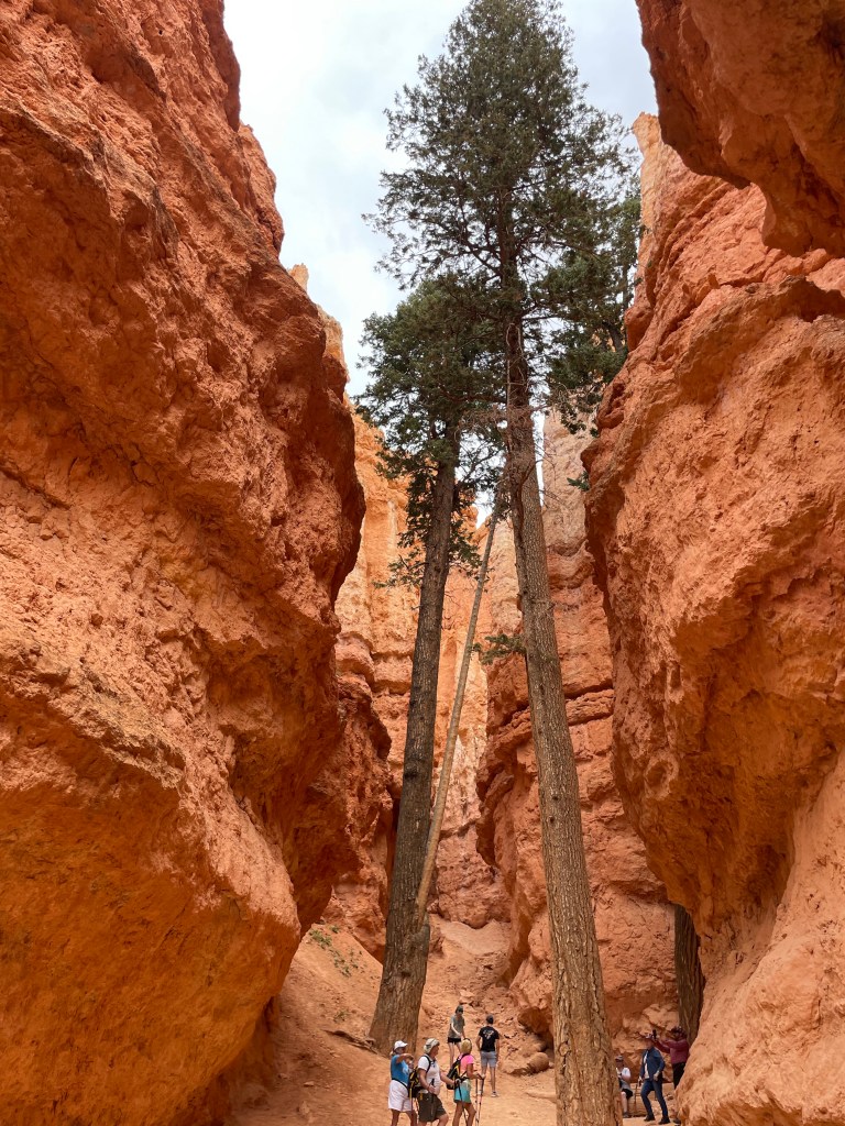
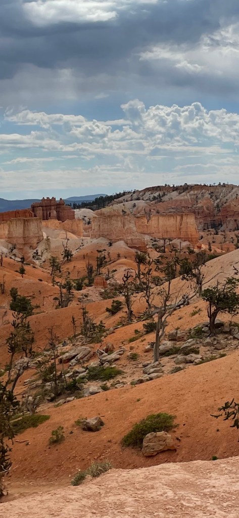
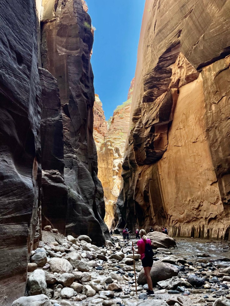
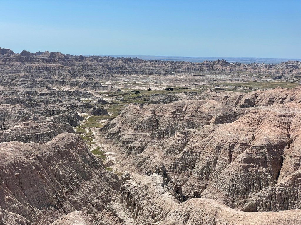
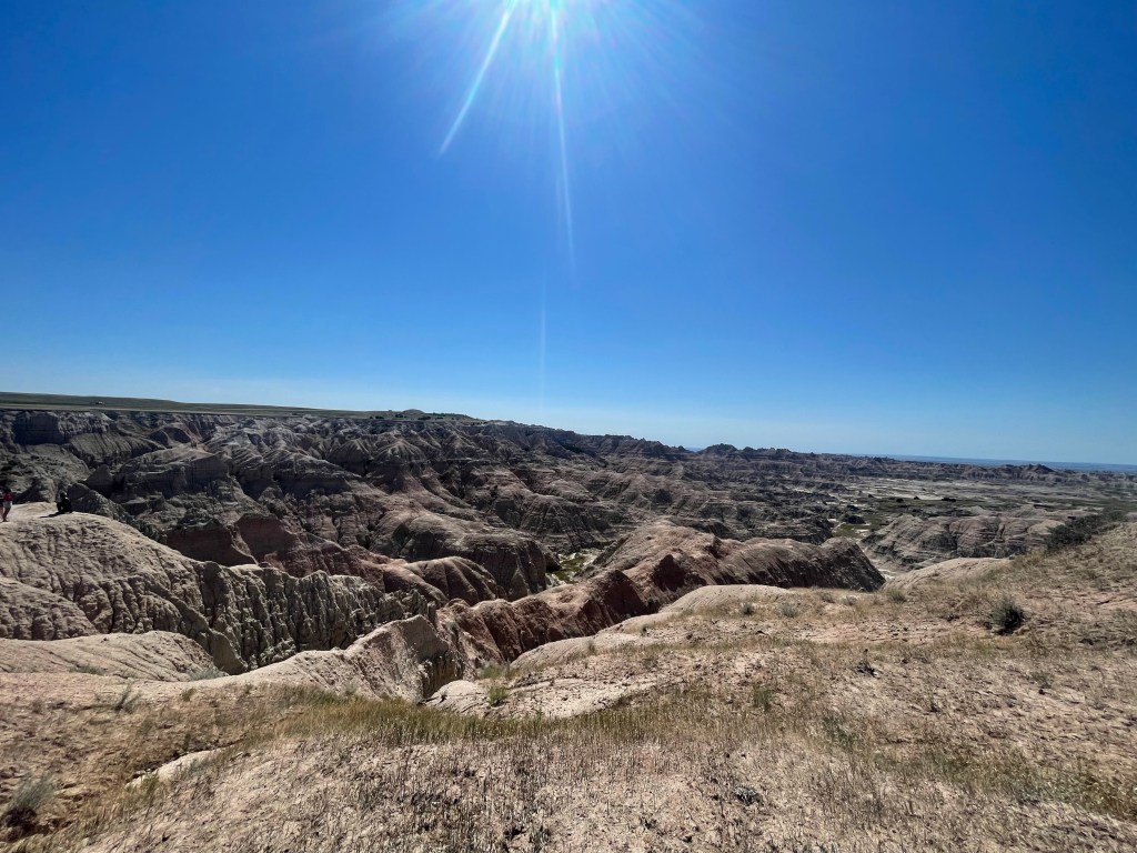
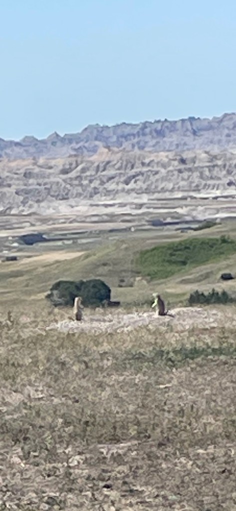
The next morning, we ended up going to Badlands National Park and I tell you what, I felt like I was in an episode of Road Runner and Wile E. Coyote all day. It was cool but was really a smaller less colorful version of the painted desert we had seen in Arizona. We did the “badlands loop” and let me tell you knowing what we know now, we would have skipped the unpaved parts of it and just driven through the main portion which is the prettiest. One of the funnest parts was all the prarie dogs! There are hundreds of them!

Beautiful
The black hills
Prairie dogs everywhere
Buffalo anyone?

Then to wrap up our day we ended up at the Minuteman National Landmark which is a historic missile site used right up through the 1990’s. Apparently, in 5 states the US still had “Inter Continental Ballistic Missiles” ready to launch at a moments’ notice which is what keeps the peace with the other nuclear superpowers. They call is “MAD” which means Mutual Assured Destruction. Nothing unsettling about that. The little informative movie and the exhibit talks about how much less risk there is now of nuclear destruction but based on what I see daily in the news with Ukraine, it is hard to still see it that way. They tried hard to convince the audience that the Bay of Pigs in the 1960’s was the closest the world has ever come to nuclear war.

Big Sky Country Cody, Wyoming, USA, July 28, 2022

Big Sky Country Cody, Wyoming, USA, July 28, 2022

As we left Idaho, we tripped over these two little beauties – Upper and Lower Mesa Falls before heading to “Big Sky Country.”

Lower Messa falls
Upper Messa falls
Upper Messa falls

There is definitely a reason they call it this and I must admit Wyoming caught me by surprise.  I have never heard anyone talk about how beautiful it is here!  We didn’t have any intention of stopping here but Cody had Mexican, so we made the command decision.   We were on our way to Yellowstone and this was the only place with hotels left.  We went to see the volcanic geysers since the park sits on top of a volcanic hotspot and even got to see old Faithful erupt.  She draws quite an audience!

Prismatic pool
The orange color is actually a biomate

I had hoped to see a bear but no luck. We did get to see the park as it has rejuvenated from the wildfires and it seems to be coming back quite nicely. The park and the unique rock formations are quite beautiful all through the 3.500 mile park. We also drove through part of Grand Tetons as well.

Yellowstone lake
Incredible rock cliffs at side of road
Snow capped peaks of Yellowstone

Undressing on the Road – California, Oregon, Idaho USA – July 24, 2022

Undressing on the Road – California, Oregon, Idaho USA – July 24, 2022

Avenue of the Giant was awesome and as we finished it out, we decided to start our trek east via the northerly route across the US since any farther would not result in any warmer temperatures. During our ride from Fortuna, California (50 degrees) this morning to our final stop on our way got us back to 107 degrees (well that was fast) and the 50 degree swings in temperatures presents an interesting challenge as to what to wear in the morning. I have become quite adept at changing clothes on the road to accommodate. Ron, on the other hand has adapted his strategy differently than I have and it isn’t quite flawless yet.

Cold wet ride until you are above the clouds
Pure fashion

Oregon was…interesting.  It now holds the record in our books for the worst Mexican Food, we drove through not one, but two swarms of locus, and we drove through the town of Weed.

Interesting place

Other noteworthy items were the fact we drove by Lake Albert.  It is an inland saltwater lake that is disappearing, and no one knows why.  Here is all that is left, and the salt looks like snow does it not?

15 miles of dry lake Albert

But not all was lost since we did get to see the 14,000 foot Mount Shasta Volcano.  Coors Light anyone?

Idaho is nearly what I thought except for one surprise.  It is the largest farmland stretch I have ever seen, the roads are nice, and gas is cheap again.  We got to see the Blue Mountains which are pretty but the thing that surprised me the most was the gigantic sand dunes!  I realize we are driving through a section of the country called “the high desert,” but somehow it was just not what I expected to see.

More Trees Please? – San Francisco, CA, USA, July 20, 2022

More Trees Please? – San Francisco, CA, USA, July 20, 2022

We finally made it to the coast!  Woo Hoo!  That is about as long as the fun lasted, since it was 50 degrees!  I don’t know if you have ever ridden a motorcycle at 50 but Ron and I were wearing nearly every piece of clothing we brought.  There is this interesting little weather phenomenon that we underestimated regarding how fast the temperature drops.  I guess it’s time to change plans again.

Teeth chattering selfie
That did not work out as planned

So, we discussed our options over a lovely lunch in Sausalito (one of my favorite places). Hotels were sold out if we went south. We had already done the route directly east and didn’t want to backtrack. It was still cold north, but I still wanted to see the Redwood Forest. When suggesting this I thought Ron was going to punch me even after hearing the argument that if we went inland it wasn’t so bad. We really wanted to ride PC1 up the coast but being this cold was not ideal. Lastly, we did talk about selling the bike and taking off for Hawaii for the next couple months. After must applied logic, in the end, we decided to go north. We would try to hit the Redwood Forest even if we went inland.

The good news after about an hour inland, it did start to warm up.  We made a pitstop at a rest area and the “attendant” (or some old dude in a very convincing, official looking vest), told us about a route we HAD to ride which was on our way.  Having no better ideas, we listened to him, and boy was he right!  We landed right in the middle of “The Avenue of the Giants!”  This is an incredible stretch of about 90 miles where there are coastal Redwood Trees everywhere!  It was gorgeous!  I am including the video to give you a flare of the roads and trees.  It doesn’t do it justice but still pretty cool.

What an incredible ride
Monster Redwoods everywhere

Big Trees – Jackson, CA, USA, July 17, 2022

Big TreesJackson, CA, USA, July 17, 2022

Flexibility has been key in our travels.  For example, when we encountered 100+ temperatures, we changed plans to get out of AZ.  Then, when the hotels in southern California appeared all booked, so we headed north (hard to believe there is a recession looming when EVERYONE is on vacation!).  We had hoped to go to Yosemite and Sequoia National Parks, but due to the wildfires closing off the roads, we changed plans yet again. 

To fill our big tree quota, we headed to Calaveras State Park in Northern California allowing us to see the Sequoias and get an affordable hotel. We snaked our way over the Sierra Neveda Mountains which are stunning with huge pine trees everywhere.

Certainly a change from the high desert country

Then we took a 5-mile hike to explore the park.  The sequoias are wider than the redwoods and the redwoods are taller than the sequoias.  Naturally growing sequoias are only found in California (west of the Sierra Nevada mountains) and China due to the specific growing conditions required which is moderate winter temperatures, great amount of water but low humidity.  Sequoias can get to an age of 3,000 years old.  We loved seeing these trees up close.

It is hard to not feel small by comparison
Perfect place for a tiny house.
Sierra redwoods

4,000 Miles to The Loneliest Road – Jackson, CA, USA, July 16, 2022

4,000 Miles to The Loneliest Road – Jackson, CA, USA, July 16, 2022

We have spent the last several days travelling Route 50 which looks something like this. Nothingness.

Long hot road to nowhere.
On a long and lonesome highway
East of Omaha
You can listen to the engine
Moanin’ out his one note song

One of the days when we were going through Great Basin National Park, we passed exactly 11 cars and one gas station over the course of our 300ish miles.  This brings us a new element to our trip where we now plan our daily destination then get to cross check the gas stations vs. milage to ensure we can make it without having to walk!  Route 50 is called the loneliest road and is said to be one of the most dangerous in Nevada due to some of the switchbacks but since there was no adverse weather, I think we were fine.

Lonely road is an understatement

Since Ron did a 3,500-mile trip report, I decided to tag on with my own in random order.  These are my “lessons learned.”

  • We have not paid over $5.69 per gallon for gas
  • There is a place called Hidden Valley.  It’s in Utah and they don’t make salad dressing there. 
  • The west has brought on a whole set of road dangers including haboobs, dust storms, scorching heat, overheating brakes, and cattle grids.
  • Doing the “hotel shuffle” can get old but we had added a few new tools to our bag like the priceline app which seems to be helping us.  When we start to feel this way it helps to stay put for a few days til we feel up to the challenge again.
  • I am surprised how many hotels offer laundry
  • While Ron’s Road song may be “Horse with No Name”, mine sounds more like “Holiday Road” (movie Vacation).
  • People we have met on the road have two questions for us.  “You didn’t really ride all the way from Ohio, did you?”  The other question is, “Where’s the trailer?”  I guess they can’t believe we can come this far on a motorcycle with so little stuff.  It is kind of funny and clear they think we are nuts.

But all in all, we are still having fun, seeing cool stuff, and this is worth the challenges it brings with it.

It’s a Conspiracy – Panguitch, UT, USA – Bryce National Park, July 14, 2022

It’s a ConspiracyPanguitch, UT, USA – Bryce National Park, July 14, 2022

We were still worn out from our walk through the Narrows yesterday but had to push on since there were no more hotels in Zion. So off we went to Bryce National Park. We arrived about noon and decided to do a drive through the park & Dixie National Forest for starters since neither of us were interested in hiking. The park was lovely, but I almost felt bad since I was too tired after seeing Zion, and had a hard time summoning the proper set of ooh’s and ahh’s it probably deserved. I kind of wish I had come here first, then Zion. At least we didn’t fly into the oh-so-technical Bryce Airport with it’s top notch security and we did avoid all the prairie dogs!

Perhaps the runway marker?
This is a new sign

Then, on our way to find a hotel which was more of a process than we wanted, it started to rain.  I swear the rain God, Heat Fairy, and what’s that guy from Allstate…Mayhem?  It’s a conspiracy and they are all in it together.  But we did manage to find a motel.  You heard right, motel complete with 1950’s pink & green tile and original prison sink.  I forget how much having a separate faucet for hot and one for cold is a pain, but it was clean, so we stayed.

The next morning after we had dried out, we headed over to hike and give Bryce it’s fair shake. We hiked the Queen’s Garden trail to Navajo Loop though “Wall Street.” Which really means we got up close and personal with the Hoodoos. While a hoodoo is a religious practice in the Caribbean, it’s a pinnacle of weathered rock here in the US. They were beautiful and I take back what I said earlier about the ohhing and aahing. Even the Red Canyon is lovely and the dirt is a very firey orange instead of the reddish purple we had seen in New Mexico and Sedona.

One of the many arches
The amphitheater, which we hiked the next day.
Up close and personal hoodoo
How do these grow here?
The long walk out
Too many switch backs to count

One surprising thing about the park was the amount if fire damage we saw here.  It was considerably more than anywhere else.  The “Left Fork” fire had damaged over 4,000 acres of Dixie National Forest which overlaps with Bryce Canyon.  I also learned that the designation of national forest doesn’t have the same protections as a national park.  In a national forest, resources are managed for sustainability, but they can be removed from the park.  For example, there is logging in Dixie National Forest which is not allowed in Bryce National Park where no resources can’t be taken.  There are 154 National forests & grasslands in the US which occupy 8.5% of U.S. land and is roughly the size of Texas.

So much fire damage.
Even trees down in the hoodoo garden were not safe

The Heat Fairy – July 11, 2022, Zion National Park, Utah, USA

The Heat Fairy – July 11, 2022, Zion National Park, Utah, USA

The heat fairy is a bitch.  I know this since I have had heat stroke 2 of the last 3 days.  On top of this, we lost the brakes on the bike today.  We were enjoying a perfectly lovely 100-degree day coasting through the switchbacks of the park, until we weren’t.  OK, it isn’t as bad as it sounds since it was only the back brakes, and my biker hubby knows multiple ways to brake.  We pulled over for a bit, enjoyed the views and started again.  We did actually make it down.  And oh the views were amazing!!! 

Zion National Park is a slot canyon like Antelope but has more diversity with the magnitude and ridged cut cliffs like Grand Canyon.  When we started out it was the ridged cliffs followed by the spiraling rocks that had layer after layer of hardened rock that looked like it could have been pulled back like an onion.   There are a couple things I can tell you which won’t be cited in the brochure – halfway through the park it smells like pine and in the tunnel, it gets cold!  Zion is deserving of its popularity. 

The mountains range is incredible
So many colors
Complete with tunnels through the mountain.
Dark and cool
A short stop to allow the brakes to cool.

The next morning, we had decided to hike “The Narrows” trail. Essentially you walk upriver at the bottom of the canyon. It can range anywhere from ankle deep to upper thigh. It was amazing but after our 4-hour hike we were very happy to jump back on the shuttle!

Weeping rock section
Flash flood warnings for this day.
Crystal clear water
One of the few times you could see the sky.

It’s a Good Day to DieBoulder City, NV, USA, July 10, 2022

It’s a Good Day to DieBoulder City, NV, USA, July 10, 2022

He said if we got started early, we would get there before we die.  He lied.  We had to drive 3.5 hours through Las Vegas and when we got to Hoover Dam, it was 108.  Let’s just say we are stupid.  We didn’t want to hit any of the national parks in a weekend to try avoid the crowds and had to option today of staying another day in Utah or we could drive to see Hoover Dam.  Well, we chose poorly.  For whatever hair brain reason, we left.  Barely alive, we made it.

4 waters and a giant diet coke later

Hoover Dam is one of the manmade wonders of the world and the sole reason Boulder City exists.  It was made up of all the workers and their families who move here to work on the Dam.  It was originally named Boulder Damn by President Roosevelt, but the name was later changed to Hoover since he had such a large role when Secretary of Commerce getting all the states in agreement and getting the funds approved through congress.  He felt the project as a way to kickstart the economy after the Great Depression and to some degree it worked.  The working conditions were horrible, and the dam took 6 years to complete.  Surprisingly only 96 men lost their lives during construction.  It is very complex and an engineering marvel for the 1930’s.

It is smaller than the Glen Canyon Dam and Ron was a bit underwhelmed.  I am not sure if it was because we were both so spent by the time we got there or it just because it wasn’t what he thought.  Either way, we took our tour then grabbed a hotel to stay for the next couple of days, recovering and deciding next steps now that we were on the sun.

Long way down!
One of four water intakes
Can we go find some shade now?

3500 Mile Report, Boulder City, NV

Somewhere along the Mojave Desert on a date I can not remember….

Ever listen to the song “Horse with No Name” by America? You should give it a listen. I have had this song playing through my head since we began this trip, perhaps it was the environment.

To date we are 3500+ miles into this adventure as we sit here at top of Hoover Damn in 114 degree temperatures. So far it has been a pretty epic trip (with not so epic logistic.) Much like in sailing, the weather has dictated when, where, and what time we ride. It was pretty easy until we hit Texas, when once you get west of Texas into New Mexico, you start to experience weather events which include dust storms, monsoons, and surface heat equivalent to the sun. Much like our sailing season we were clueless as to the extent the weather would play. I thought once we get to the southwest it would be hot but monsoon rains and dust storms were not really part of that picture. I should of paid more attention in geography class as a kid! I guess it makes sense, most of the incredible views in the southwest has been made from those monsoon rains and epic wind storms. Unlike sailing weather you can not just listen to the weather report and plan, here in the desert these events tend to pop up at random (or random to me). Thankfully you can see them coming from miles away so you can alter plans accordingly. A ranger told us to stay out of the canyons when there is rain on the horizon, these places tend to flash flood in an instant and well the Harley does not float. Same goes for the wind storms. Dust storms however only happen when the winds top 70MPH+. The reasoning is all the smaller dust has long since been blown away. Higher winds mean larger “pebbles”. I can not imagine riding into one of those. In contrast we have experienced the mushy feeling of the bike tires melting on the desert highway, the sensation of your sunglasses being blown from your face in an unexpected crosswind or a sunburn on top of your SPF75 soaked skin. It has been an adventure!

Back to the logistics of this trip. Since the distance we travel in a day is based on the heat, random weather events and traffic we do not reserve a hotel room in advance. Instead it is easier to just ride until you get tired or find an interesting place to explore. At that point it is easy to find a hotel in that area. Gas stops however require a bit more planning. The Harley gets about 50MPG and holds about 4 gallons of fuel. That gives us range of 200 miles. Seems pretty reasonable until you get to the isolation of some of the desert roads where you can go 50-75 miles with nothing in sight. After a few close calls we now refuel before we get to less then 2 gallons of fuel on board. Ever push an out of gas Harley? I have and you do not want to do it. A long day for us is about 350 highway miles. It’s easy to do in a car where you are protected from the elements but a bit brutal out in the sun, wind and rain. Typically we roll into town, see what hotel options we have, drive by them in an attempt to see if they are in an area where we feel safe that the bike will be there the next morning. You can not really trust the reviews, we have been burnt a few times. All in all it is pretty simple once I put it into words. Going from a life of super structure to one that is changing every few hours is exactly what this journey was suppose to be. The inner growth potential has been incredible!

One last comment before I stop rambling. I have had several people comment on doing this trip on a motorcycle. Sure it is a bit more difficult then in a car where you are sheltered from the elements I have written about above and to be honest, I would not have wanted to do this trip any other way. The experience is so much more immersive. You smell the incoming rain storm, you can feel the temperature changes of the elevation changes. The dry smell of the desert in contrast to the sweet smell of pine as climb out of the valleys. It is just an experience that can not be missed and one we had not intended.

Personalized parking space

Navajo Nation – Kabab, Utah, July 8, 2022

Navajo nation – Kabab, Utah, July 8, 2022

It’s funny just when you think the last thing you saw cannot possibly be topped, there’s more.  The western US in general is incredible but today we had a chance to tour Antelope Canyon.  This is merely by chance, since based on our last-minute booking style, we got the last two tickets for a 9:45am tour and joined a family from Belgium.  Our tour guide was Elijah, who was a native Navajo. 

I know it seems like we do a lot of cave & canyon tours but this one was so different, it is a “slot canyon” and unlike anything else we had ever seen.  The landscape around seemed to be getting rounder & smoother compared to the mountains and the Grand Canyon and they are called spiraling rocks.  It was a mixture of sandstone, limestone, and had a bit of sparkle.  The difference between the Upper and Lower canyons it the Upper is an “A” shape and the lower a “V” shape.  Our guide had photos of when it was closed this past week due to flash floods and they must go in and clean out the canyon.  The water was up to their knees, and he said they spent several days working to get it reopen. 

No words
Natures beauty
The arch
The Lady in the wind – Sally’s favorite

I guess I didn’t realize when we toured the Grand Canyon that the US National Park only preserves about half of it.  The rest is looked after by Navajo Nation, who also owns and runs all the spiraling canyon tours.  Riding through Navajo Nation was interesting.  There were no farms, no livestock, lots of run-down trailers & RV’s (as their homes), and aside from the few trading posts (gas stations & jewelry stands), I had a hard time seeing how they made a living.  Navajo Nation is a Sovereign Nation which has more acreage that the state of West Virginia and crosses three states including New Mexico, Arizona, and Utah.  Although they are sovereign in nature, the US does own them, and their laws are approved by the department of Interior.  They are considered Wards of the Federal Government and not required to follow state laws where their reservations reside. 

We toured some pretty amazing things here today including Glen Canyon Dam which makes the Powell Lake Reservoir.  It is used as a major source for hydropower and regulates the water equitably across the western states.

Glen Canyon Dam

Then we HAD to go see horseshoe bend, I mean come on – we were right here!  So even though it was a 20-minute walk and 95 degrees, Ron agreed to let me drag him here.  It was worth it and after our iconic view we drove a bit to settle for the night in Kabab, Utah.  It might be time for a day off soon!

Horseshoe Bend

Red Rock CapitalPage, AZ. July 7, 2022

Red Rock Capital – Page, AZ. July 7, 2022

Sedona is a land of stunning red mountain formations, tourism explosion via PINK Jeep tours, and the rich.  We spent the last couple days hiking with Daughter #1 and it has been lovely.  A bit crowded but nothing like I was expecting which was great.  There are benefits to seeing the sights on a Tuesday or Wednesday!

The first day we did a short hike, Sugar Loaf, then checked in before dinner (Mexican, of course). We did not expect $12 beers ouch! We woke the next morning and did a longer hike called Devil’s Bridge.  It is exactly as it sounds but only about 4 miles.  The only deterrent is the heat.  We made it and were glad we did.

Beautiful view!
The views from hike to Devils Bridge

Daughter #1 had to get back for plans with friends, so we decided to push forward a few hours spending the night in Williams, AZ.  The next morning, we took our time and drove through Grand Canyon National Park’s south rim.  Doing it on the motorcycle was amazing and we saw so much.  It is truly impossible to capture the vastness of it all.  The Grand Canyon is 278 miles created by the Colorado River over 5-6 million years ago.  It is considered to be a key piece of history for the pueblo people and historians have uncovered many fossils documenting their existence there.

South Rim Grand Canyon
East End Grand Canyon

After an incredible day of sight-seeing, we stopped for the night in Page, AZ.

Arizona was a Shocker – July 4, 2022, Phoenix, AZ, USA

Arizona was a Shocker – July 4, 2022, Phoenix, AZ, USA

Happy 4th of July!  We arrived here 3 days ago, and it has not been under 103 yet.  Riding a motorcycle in Arizona in July was a stupid idea…honestly, who does this?  It is like riding on the sun.  I was not surprised that it was hot, but I don’t remember it being this hot any other time I have been here.  The surprise was the wind!  One of the rangers said there are no snow days here, but they do have wind days since they cannot operate the school busses when the winds are 50MPH+ and that they can get up to 80MPH.  Haboob anyone?  He warned us not to be in the canyons when the monsoons hit (every day between 12pm-5pm) since that was when there were many rockslides. 

Usually when I came here it was for work.  I flew in, went to the hotel, did whatever event or customer call I was there for, and flew home.  I had not really seen any of Arizona other that Camelback Mountain from a distance and drove through Sedona once.  When I though of AZ I always thought of a new, planned city where all the streets were square, and the rest was just sand.  This could not be farther from the truth about Arizona. 

I have to say, outside of the heat, I forget how beautiful it is here.  On our way here we drove past the Coconino National Forest.  It’s 1.8 million acres in northern Arizona that is almost exclusively pine.  As we drove it smelled like pine.  Sadly, we could see some of the damage to not only the pine forest but as we drove to the hillsides covered in cacti as well.  There were only skeletons of them left standing.

Riding on the sun

Our first stop was to see the Petrified Forest.  It’s the only forest I have seen where none of the trees are standing up and I was not expecting to see trees made of quartz.  It appears they have been cut but actually, when they start to stick out of the mountains, break when the sands move from under them.  They are beautiful.  It’s a smaller national park and only about 350 miles and I don’t remember hearing much about this as I think it is overshadowed by the Grand Canyon, but it was a worthy stop, and I am glad we got a few hours there before the rain chased us out

Crystal trees

This national park is also home to the painted desert and rainbow mountains, and they are stunning.  It was time to dig out the drone!  Ron took a bunch of footage, but we aren’t going to post since it is very choppy so take a look at the photos instead.  The layers of colorful rock were caused by the movement of the tectonic plates and volcanos (which are no longer active).

Incredible colors

Daughter #1 was the reason for our expedition to Phoenix.  She was the only one we had not seen in over 6 months, and it was way overdue.  The other reason is she has an upcoming job that starts in September in Spain so we wanted to get some time with her before she left not knowing what our schedule looked like.  We ended up staying on Phoenix over the holiday and due to the heat, talked her into going to Flagstaff with us for a few days the following week.  Since we had pushed hard and ridden everyday for a while if was a welcome break for us too.   

Skipping in the Desert – June 29, 2022, Albuquerque, NM, USA

Skipping in the Desert – June 29, 2022, Albuquerque, NM, USA

We waved goodbye to the Cadillac Ranch and welcomed Pistatioland.  Yep – we are in New Mexico.  We didn’t get to stop for a snack there but decided to hit Russell’s Travel Center and Café instead.  It is supposedly one of the nostalgic gas stations & diners.  The bonus is it also has a car museum, so we took a quick stroll.  By the way, Elvis has entered the building.

Beautifully restored cars
Ron’s favorite Willy
Elvis is everywhere out west!

I have to say the views during our ride today were stunning.  The landscape is really changing as we rode through the Sandia Mountains, which include the Cibola National Forest, we could see why it was being preserved.  There are 14 mountain ranges in New Mexico in total.  There was also evidence of the recent wildfires with charred trees but the landscape was making a comeback, especially since now was monsoon season.

Slowly we roll into the hills

Lastly is the dilapidated buildings on Route 66 which as actually iconic but have fallen into despair over the years.  You can still see the neon signs, which no longer light, but some have been long since boarded up and abandoned.  It is a bit of a ghost town at times.

If these buildings could talk
No shortage of abandoned buildings on Route 66
Not dead yet but one of the few remaining